May 24, 2022
As you plan your summer weekends and holidays, please refer to the below information from the Sulphur Ranger District.
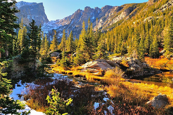
Visiting the Arapaho National Recreation Area
The Arapaho National Recreation Area includes five major reservoirs: Lake Granby, Shadow Mountain Reservoir, Monarch Lake, Willow Creek Reservoir, and Meadow Creek Reservoir, drawing in a diversity of recreational opportunities from boating and fishing to camping and hiking. Annual or day-use passes are required if you are visiting one of the developed National Forest recreation sites on these lakes including the parking lots, restrooms, boat ramps, campgrounds, and picnic areas.
Day passes can be purchased in advance on recreation.gov for one, three, or seven days. Last-minute purchases can be made using a smartphone and entering a license plate number or at one of the fee machines located around the area. Be aware that the receipts from these machines fade quickly in the sun and cannot be replaced if lost.
New this year: you don’t need an ANRA sticker!
Local residents and regular visitors to the recreation area might consider purchasing an annual pass. Annual ANRA passes are only available on recreation.gov. You may enter your license plate or print out your pass to display on the dashboard. Stickers are no longer issued. Passes are only required for passenger vehicles, not boats, trailers, snowmobiles, or ATVs. People who might also visit a National Park or other federally managed recreation area across the country this year may prefer to purchase an America the Beautiful annual pass or a lifetime pass such as a senior, military, or access pass. These passes are also accepted in the ANRA and are available for purchase on usgs.gov.
Firewood permits now available virtually
Purchase your firewood and other forest product permits before the end of October by filling out an online application located on our Forest Product Permit page. Permits are valid thru April 30, 2022.
Where can you get maps?
The best place way to navigate around the National Forest is by downloading our motor vehicle use map and forest visitor map using an app called Avenza available in your smartphone app store. This app geolocates users on the map even when there isn’t cell service. We also support the state’s trails app, COTREX. If you’d like to purchase a hard copy of the Arapaho and Roosevelt National Forest map, visit usgs.gov. We will be working to get paper maps into more locations around Grand County this summer, and there are also interactive maps and pdf maps options on our website.
Going camping?
There are three different types of camping available. Developed campground visitors should start by visiting our campground table, interactive map, or recreation.gov to determine the best place for their needs. Most reservable campgrounds booked up for weekends many months ago. We are not able to provide updated information on the availability of walk-in sites. Car campers, (aka dispersed campers), will need to start with our know before you go page for critical information. Backpackers may need to purchase a permit online in advance if headed into Indian Peaks Wilderness Area. Some areas remain closed to camping, including Vasquez and Little Vasquez and along Colo. Hwy 125.
Our New Forest Information Hub
Our visitor information resources have been centralized across the forest. You may reach our recorded line and leave a message at 970-295-6600, or email our visitor information hub at VisitARP@usda.gov. Check out our updated, mobile-friendly website www.fs.usda.gov/arp or follow us on Twitter and Facebook.